Life in the district
The Port du Rhin district, with its 2 000 or so inhabitants, has recently been re-connected to the centre of Strasbourg thanks to arrival of the tram. Since 2012 the wind of change has been sweeping through the district, in particular with the developments around the Place de l’Hippodrome and with the new Rhéna Clinc, the largest private health clinic in the Strasbourg conurbation.
The project is in keeping with the existing landscape, extending the blocks already built in the direction of the Rhine. In terms of the neighbourhood, the new builds blend in with the old apartment blocks and provide new facilities and local services. The tree-lined avenues are also extended, with occasional views opening up towards Germany. With its new projects and green open spaces, the district and its community life are coupled with a new metropolitan dynamic.
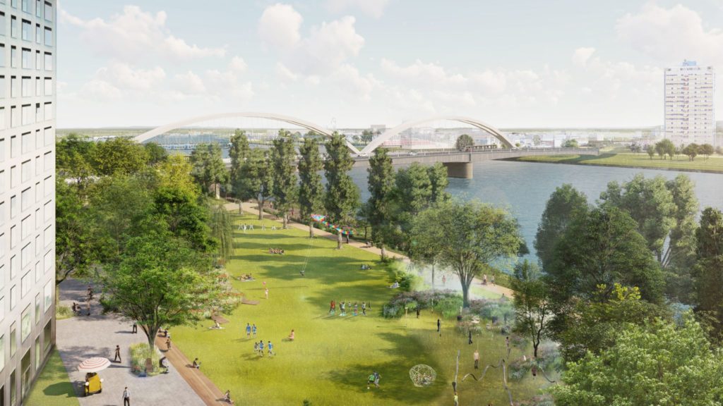
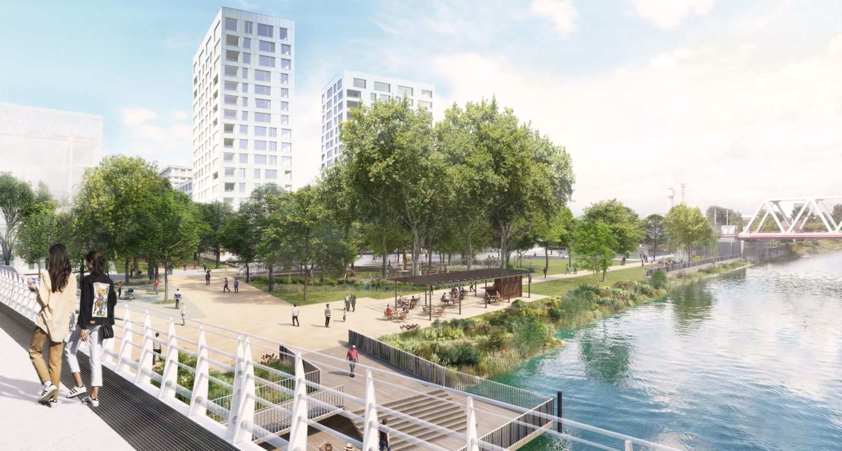
The new walkway along the Rhine is like a 60 m wide green ribbon separating the housing developments from the riverbank. It extends the Jardin des Deux-Rives and the historic district, engaging with its twin park along the banks of the Rhine on the German side. Its grassy beaches are alive with walkers, a plethora of sports and leisure activites, and places to stop for refreshments.
-
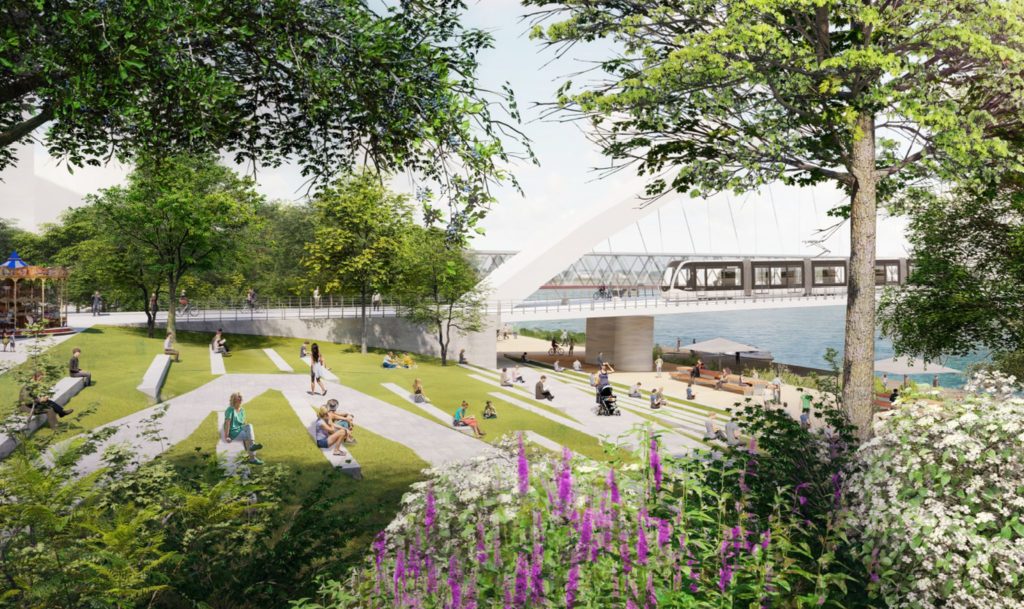
Rhine walkway at the base of the Beatus Rhenanus bridge. Credit: Agence Ter
Rhine walkway at the base of the Beatus Rhenanus bridge. Credit: Agence Ter -
The Rhine walkway will be 500m long and 60m wide. Credit: Agence Ter
The Rhine walkway will be 500m long and 60m wide. Credit: Agence Ter -
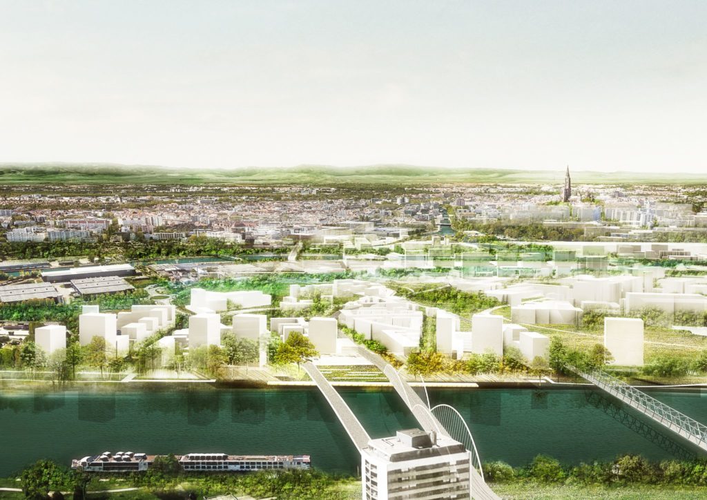
Aerial view from Kehl of the Rives & Port du Rhin district. Credit: Agence TER
Aerial view from Kehl of the Rives & Port du Rhin district. Credit: Agence TER

1500
new inhabitants

400
new workers

1
main walkway along the banks of the Rhine
10 000
m² of socio-cultural and economic activities (community services and shops, office spaces and recreational facilities)

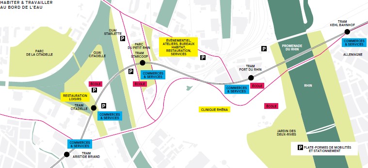
 Access and getting around
The Rives & Port du Rhin district is directly connected to the central railway stations in Strasbourg et Kehl-am-Rhein via the French-German tram line opened in 2017.
The Port du Rhin tramstop is the link with the centres of Kehl and Strasbourg. The vast network of cycle paths ensures the district is fully covered.
The Port du Rhin is a historic district with an existing network of streets and local public squares. The urban development project builds on these existing streets.
Some of them, like the Route de l’ile-des-épis, which will connect the district to the future Rhine Walkway, are extended towards the Rhine. Others, like the Rue Jean Monnet, soon the site of new builds, facilities, and public services, connect the northern parts of the district to the south.
The Place de l’Hippodrome, with its local shops, will continue to be the district’s nerve centre.
The Rhine walkway and local squares will ensure the district a good supply of green spaces, sports facilities, and play areas.
The walkway will ensure an unbroken link between the northern part of the district (the former Cour des Douanes) and the Jardin des Deux-Rives.
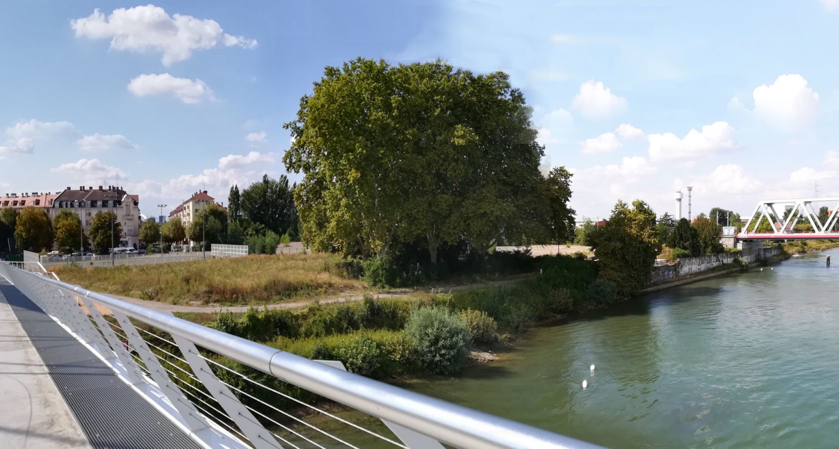
Before / After
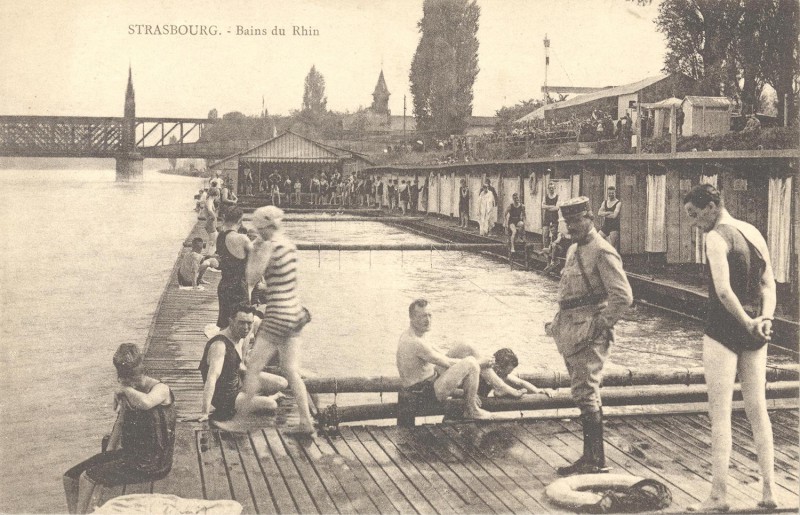
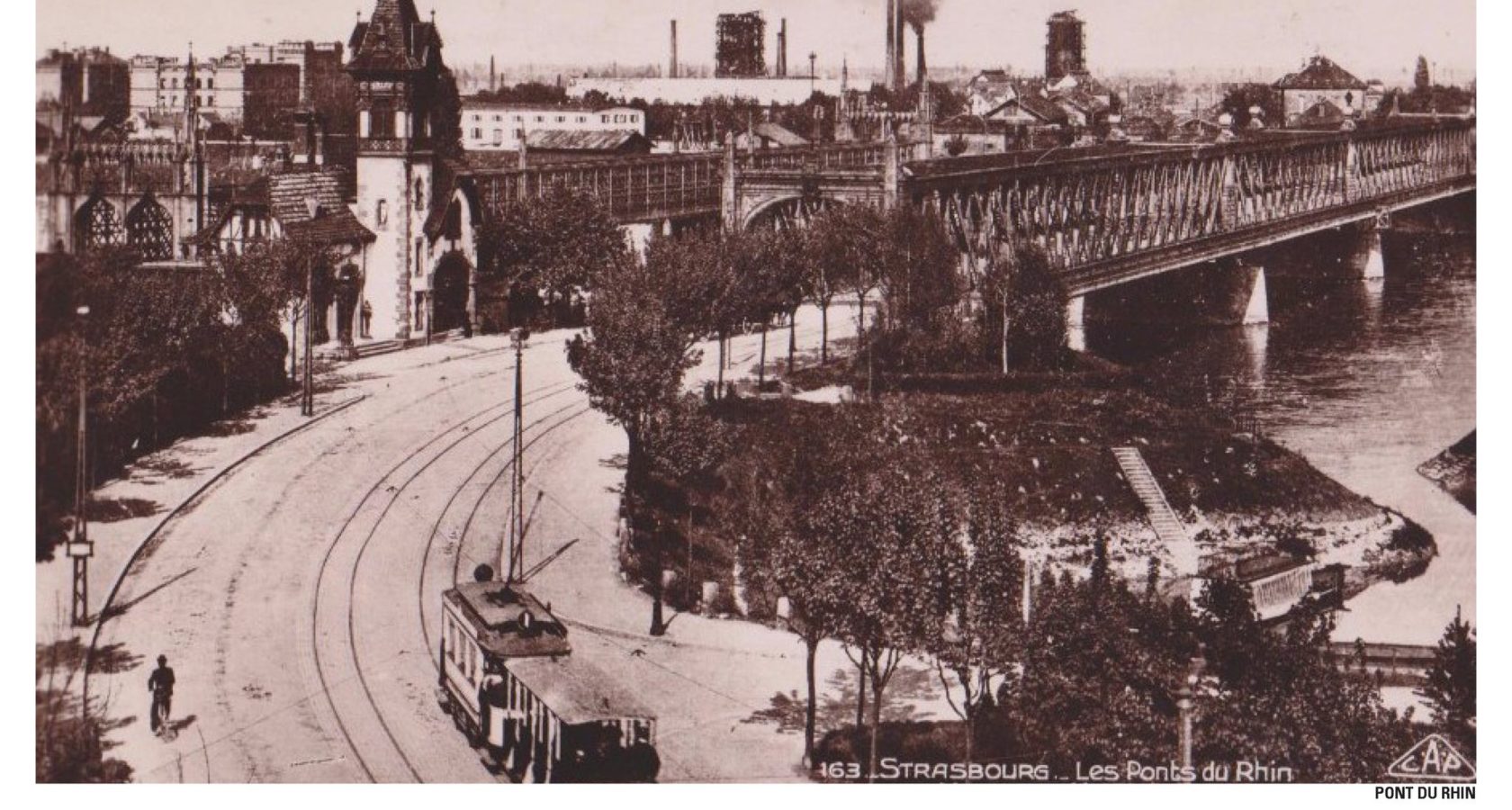
History of the district
Let's talk about it!
Would you like to know more about the project and its 4 districts? If so, the Point Coop – Café Deux-Rives is the place for you, a mediation space where you will find a project model and an exhibition dedicated to the project, along with temporary exhibitions put on by key district stakeholders, and, the cherry on the cake, a visitors’ café! The Point Coop is open to visitors every Wednesday afternoon from 2 to 6 pm.
However, if the wait is too long, you can always get in touch by filling in the form below, and we shall do what we can to answer your questions as quickly as possible!
POINT COOP — CAFÉ DEUX-RIVES
18 rue du Port du Rhin
67000 Strasbourg
+33(0)3.68.00.19.
OPENING HOURS
Wednesdays: 2 pm › 6 pm
18 rue du Port du Rhin
ACCESS
Tram D, Port du Rhin Tram Stop
N° 2 Bus Line, Coopérative Bus Stop
Do you want to get involved?