Life in the district
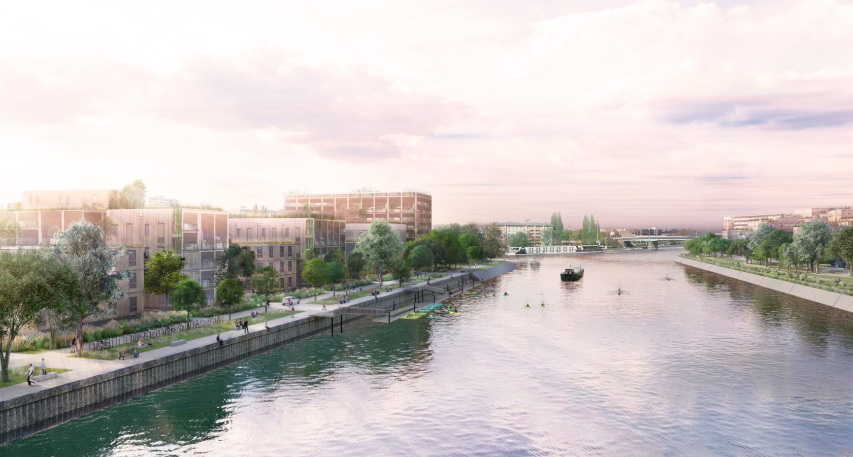
This district surrounded almost entirely by water (also known as the “Neudorf peninsula”), has all the makings of a city port. The industrial architectural heritage of the port area is transformed as it becomes home to restaurants and shops, a destination in its own right.
The quays are converted into walkways, and the northern tip is turned into a park and linked up to the Parc de la Citadelle. Productive activities are integrated into the project and port jobs (Cafés SATI ou Batorama) are saved. Thus, a link is established between what exists today and the mixed district of tomorrow. A new housing district is emerging on the waterfront, along the Vauban basin.
The district is formed of a grid of narrow streets and alleys where car traffic is restricted. The height of the buildings alternates between two and four storeys. Landscaped avenues serve the dwellings grouped together in islands. Outside areas are breathing spaces of greenery, ideal for meeting up with neighbours in shared gardens and alleys. The dwellings have extensions in the form of loggia, balconies, and patios. The roofs re-interpret the Alsatian tradition of superposed openings and light sources.
-
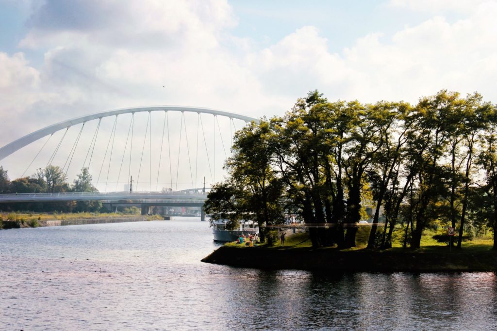
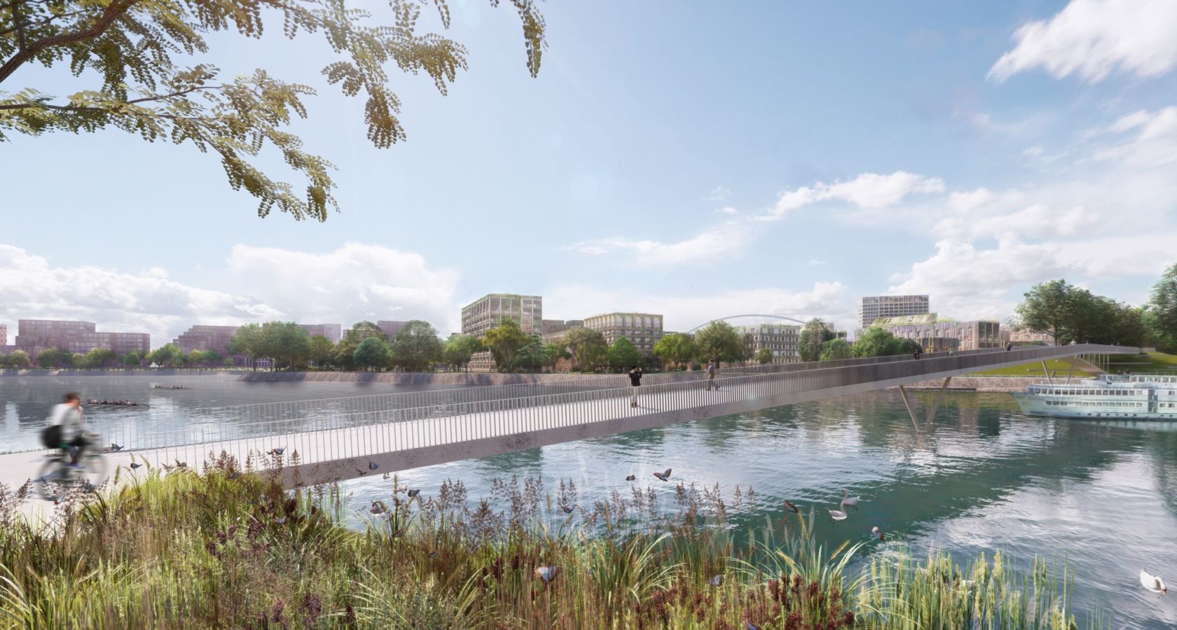
View of Citadelle from the side of the bow with the André Bord bridge in the background. Photo credit: Agence TER
View of Citadelle from the side of the bow with the André Bord bridge in the background. Photo credit: Agence TER -
View of Citadelle from the André Bord bridge. Credit: Agence TER
View of Citadelle from the André Bord bridge. Credit: Agence TER -
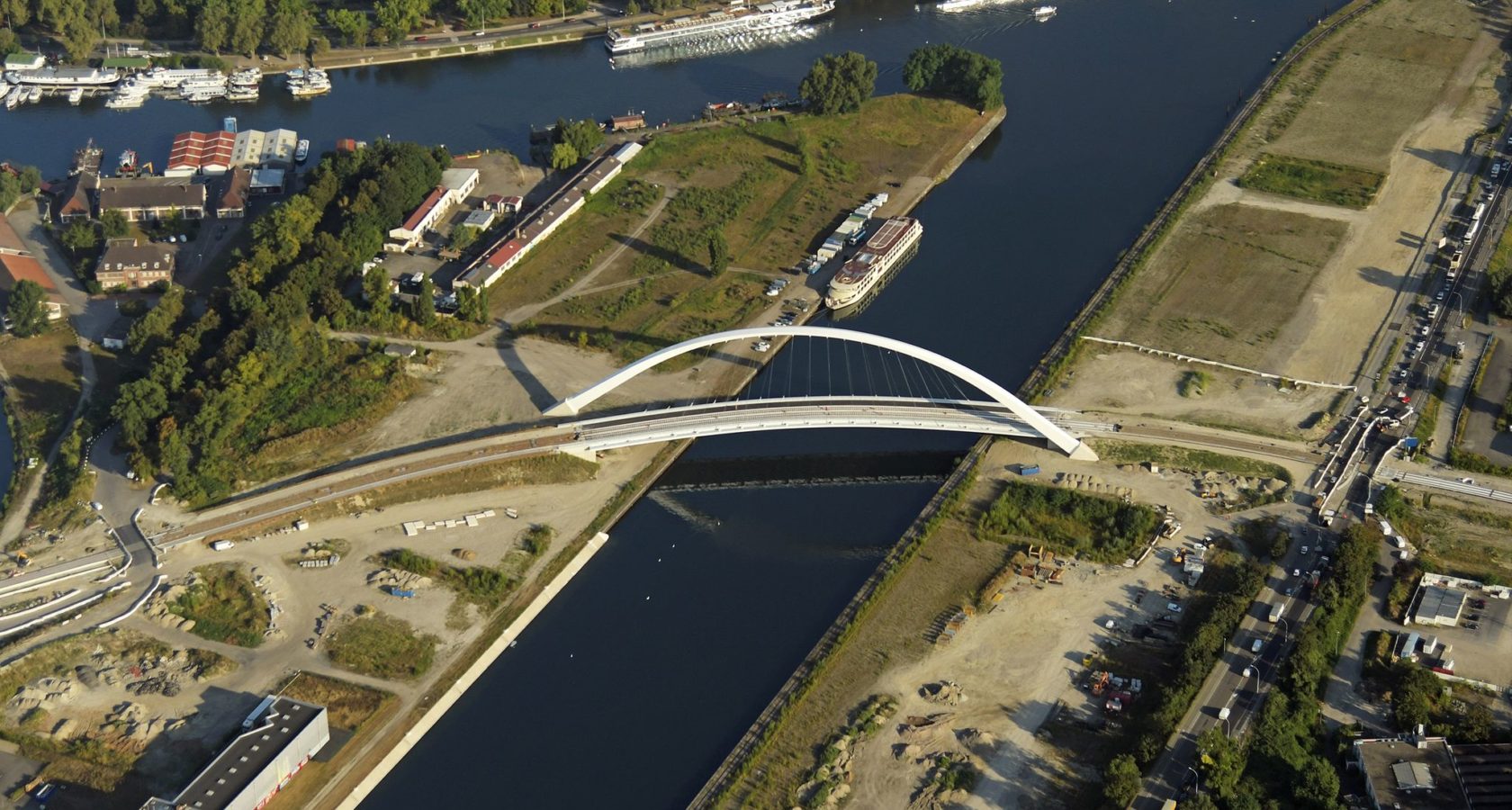
View of the Citadelle bridge. Credit: Agence TER
View of the Citadelle bridge. Credit: Agence TER

1600
inhabitants

300 workers

1 quayside walkway connected to the Parc de la Citadelle by a new footbridge
8 000 m² of socio-cultural and economic activities (citadelle shopping mall, local services, Café Sati, etc.)

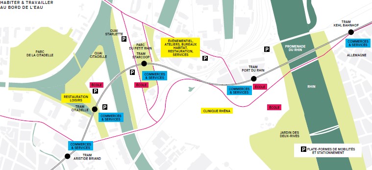
 Access and getting around
Less than 15 minutes by tram from the historic centre of Strasbourg, the peninsula is easily accessible and relieved of car traffic, with parking provided by two parking and transport hubs in the southern part of the district. Crossing the peninsula, an elevated green walkway runs along the dyke from the rue de Nantes, culminating in a viewing platform leading straight to the Parc de la Citadelle, linked to the district by a new bridge for cyclists and pedestrians that weaves its way above the water basins. Where necessary, motor vehicles have access to a one-way loop. The shops are centred around the Citadelle tramstop, already in use.
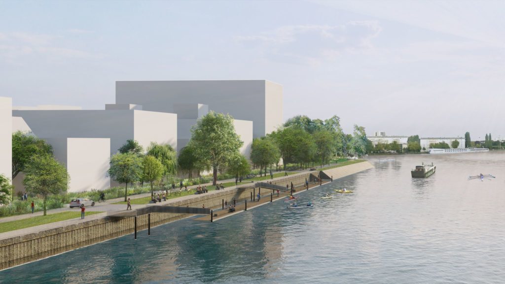
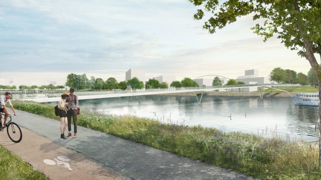
Before / After
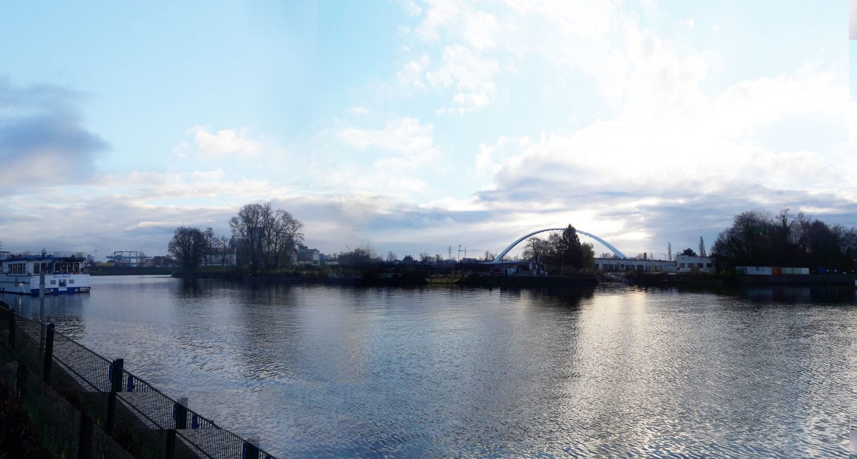
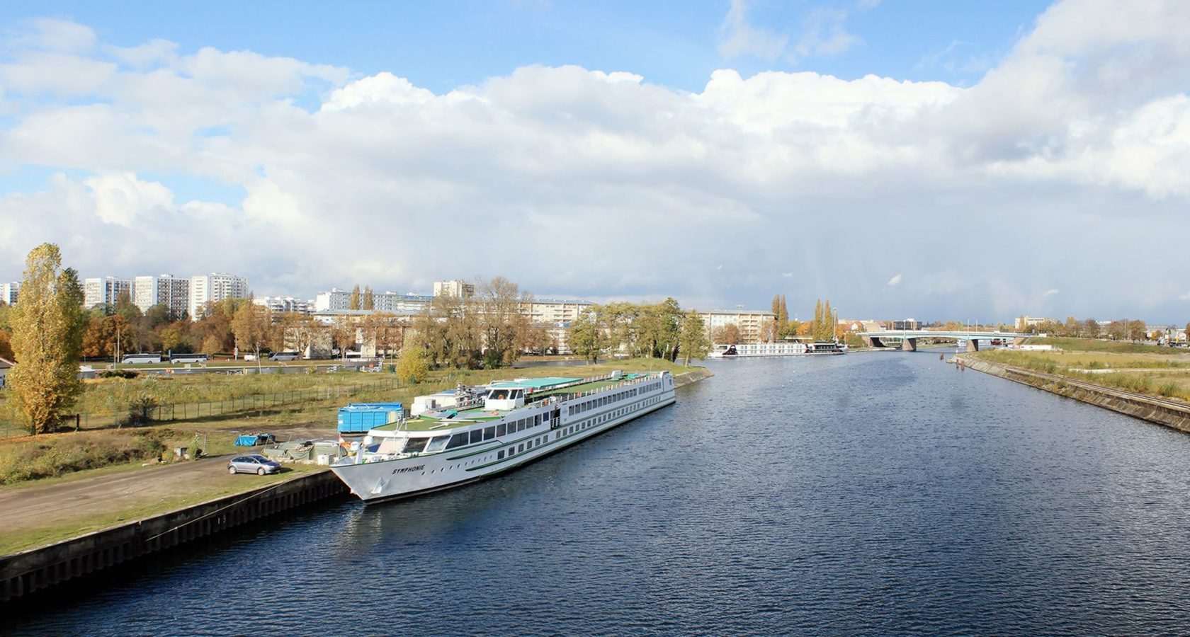
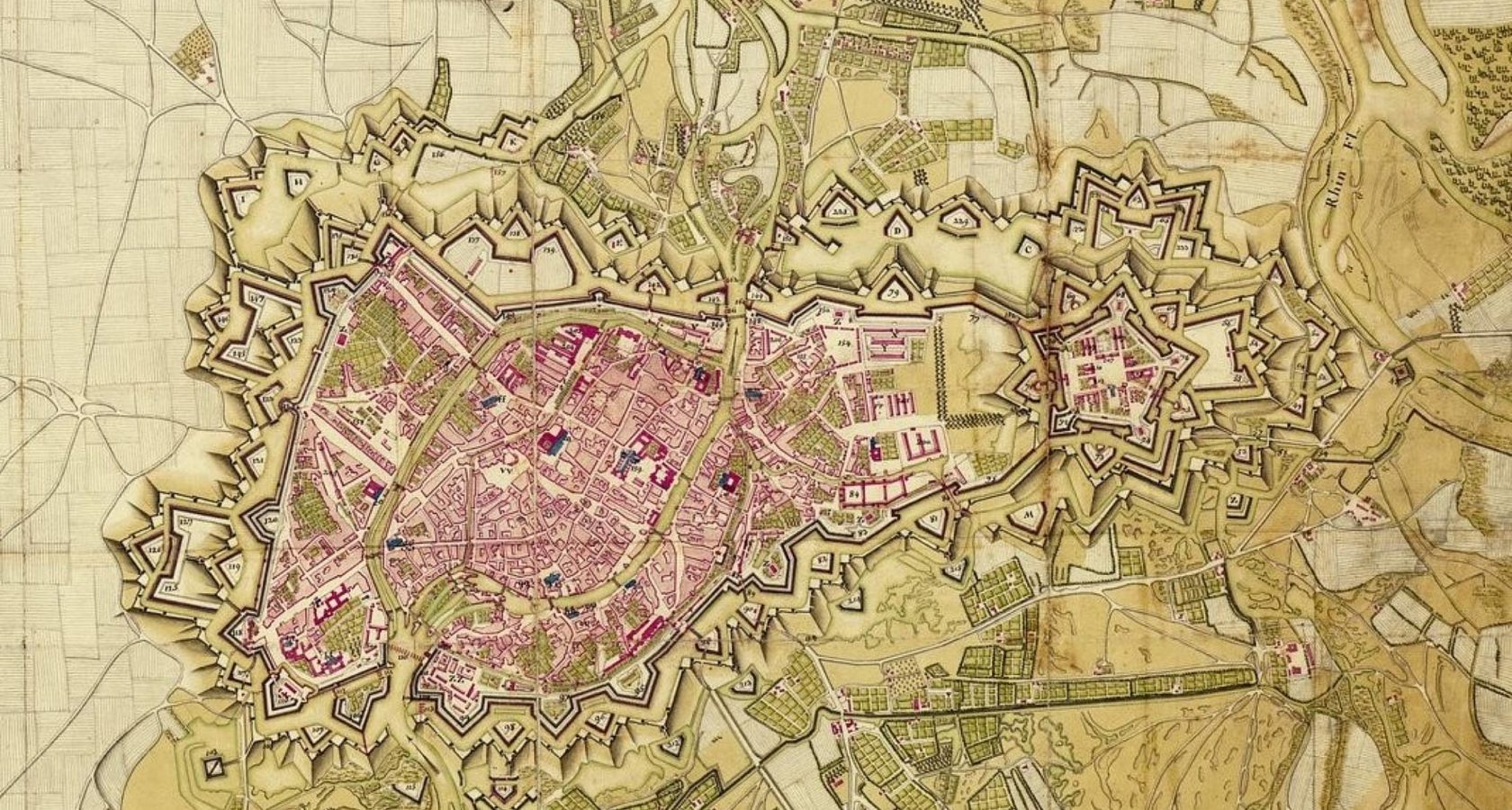
History of the district
Let's talk about it!
Would you like to know more about the project and its 4 districts? If so, the Point Coop – Café Deux-Rives is the place for you, a mediation space where you will find a project model and an exhibition dedicated to the project, along with temporary exhibitions put on by key district stakeholders, and, the cherry on the cake, a visitors’ café! The Point Coop is open to visitors every Wednesday afternoon from 2 to 6 pm.
However, if the wait is too long, you can always get in touch by filling in the form below, and we shall do what we can to answer your questions as quickly as possible!
POINT COOP — CAFÉ DEUX-RIVES
18 rue du Port du Rhin
67000 Strasbourg
+33(0)3.68.00.19.
OPENING HOURS
Wednesdays: 2 pm › 6 pm
18 rue du Port du Rhin
ACCESS
Tram D, Port du Rhin Tram Stop
N° 2 Bus Line, Coopérative Bus Stop
Do you want to get involved?