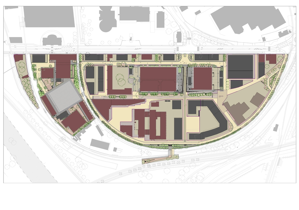
The urban project
The Deux-Rives/Zwei-Ufer project is a sign of how open Strasbourg is to the Rhine, to Germany and to the rest of Europe.
It illustrates the desire of the City to use its transborder situation to create a continuous urban space commensurate with the strengthening of Franco-German relations and Strasbourg’s claim to being the capital of Europe. Site of France’s 2nd largest river port and with its atypical industrial port heritage, Strasbourg is also a city-port.
The extension of the tram network towards the German town of Kehl and the development of the four new districts, Citadelle, Starlette, Coop and Port du Rhin mark the latest phase in this major urban project.
Vision
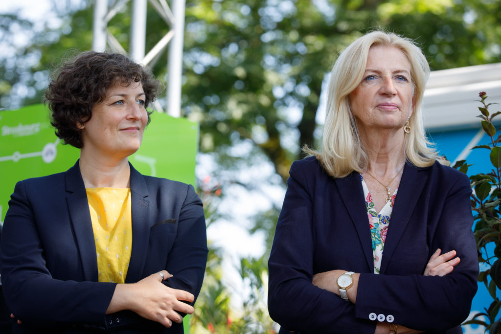
Deux-Rives project: building with nature
By ms. Jeanne Barseghian, Mayor of Strasbourg, and ms. Pia Imbs, President of Strasbourg Eurometropole (written in French).
The largest development project in our region, the Deux-Rives project extends from Neudorf to the banks of the Rhine and offers continuity from Heyritz Park to Kehl-am-Rhein. This project forges links, breaks the isolation of historic districts, long on the margins, and offers a new destiny to this vast region, located in the heart of the port of Strasbourg.
The history of the Project
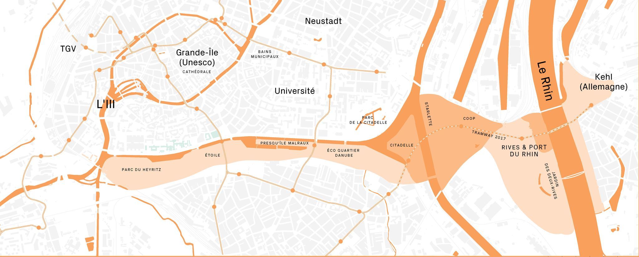
The second half of the 20th century saw Strasbourg develop towards the north, south and west at the expense of its border with Germany. Anxious to renew its ties with its neighbour across the Rhine, meet the growing need for housing and avoid urban sprawl by recycling wastelands, in the 1990s, Strasbourg launched its largest urban development project since that of Neustadt: the transformation of some 250 hectares of port wasteland extending from the Ill to the banks of the Rhine, from Strasbourg’s Heyritz district to the German city of Kehl-am-Rhein.
The Deux-Rives / Zwei Ufer project was born : discover its history in detail and the key figures of the project below.
After several years of studies and debate on the mutation of the port wastelands along the Rhine-Rhône canal, and on the requalification of the Rhine route, the area of the Deux Rives project began its transformation from the east.
The development of the future Heyritz district began around 1996 with the creation of facilities (college and then police headquarters).
In 2004, the Jardin des Deux-Rives was inaugurated, a cross-border park that testifies to Strasbourg’s connection with the Rhine and Germany.
Between 2005 and 2016, the former industrial port site of the Austerlitz basin and its “Armements Seegmuller” warehouses were gradually transformed into the Malraux Peninsula district.
This district is dotted with public facilities and metropolitan leisure areas (Cité de la Musique et de la Danse, André Malraux Media Library, Shadok, Rivétoile commercial centre, UGC Cinécité cinema). The old buildings (Seegmuller tower and warehouses) were renovated and transformed into facilities, housing and offices. New iconic buildings completed the urban project, with the “Black Swans” towers, designed by architect Anne Demians, and further east, the positive energy tower led by Elithis and designed with the Xtu architects. Further east, along the canal, the Danube EcoQuartier district developed.
In the early 2010s, the City and Eurométropole of Strasbourg continued its considerations on the development of the “missing link”, the urban link to connect, in a continuous pedestrian space, the cities of Strasbourg and Kehl-Am-Rhein. This region extends from the Citadelle basin to the vicinity of the SATI coffee factory, and the banks of the Rhine.
In 2010, the Urban Community of Strasbourg (which became the Eurométropole of Strasbourg on 1 January 2015) then joined forces with the Autonomous Port of Strasbourg to launch an urban study and “consultation and project workshops” to define the main lines of urban and landscape transformation of this site. Finalised in 2013, the Master Plan, designed by landscape architect Alfred Peter and architect-urban planner Bernard Reichen, was born and served as the basis for land use planning and the tramway project.
This new stage in the Deux-Rives project was achieved with the creation in December 2013 of the Deux Rives Mixed Development Zone (ZAC).
In 2014, management of the urban development of these 74 hectares was entrusted to Société Publique Locale (SPL) Deux Rives, a company created by the City and Eurométropole of Strasbourg to carry out development and construction or rehabilitation projects on the region.
In 2016, inspired by the master plan of A. Peter and B. Reichen, SPL Deux Rives led the development of the first version of the “Regional” Guide Plans (TER-51N4E-LIST-OTE agencies) and “Coop” (Alexandre Chemetoff & Associates). The challenge? To define, without definitively setting, the landscape, urban, architectural and environmental direction of ZAC Deux-Rives.
The “guide plan” studies consist of a sum of documents and plans, including the synthesis “guide plan”. For each of the 4 districts (Citadelle, Starlette, Coop, Rives & Port du Rhin), these studies helped define the fabric of public spaces (streets, green spaces, parks…), the architectural identity of each district, ecological ambitions (materials, water management, mobility, waste, etc.), urban programming (location and types of housing, offices, public facilities, shops, etc.) and the amount and phasing of the required public works.
In 2017, the extension of the tramway to the German city of Kehl marked the start of development of the 4 districts.
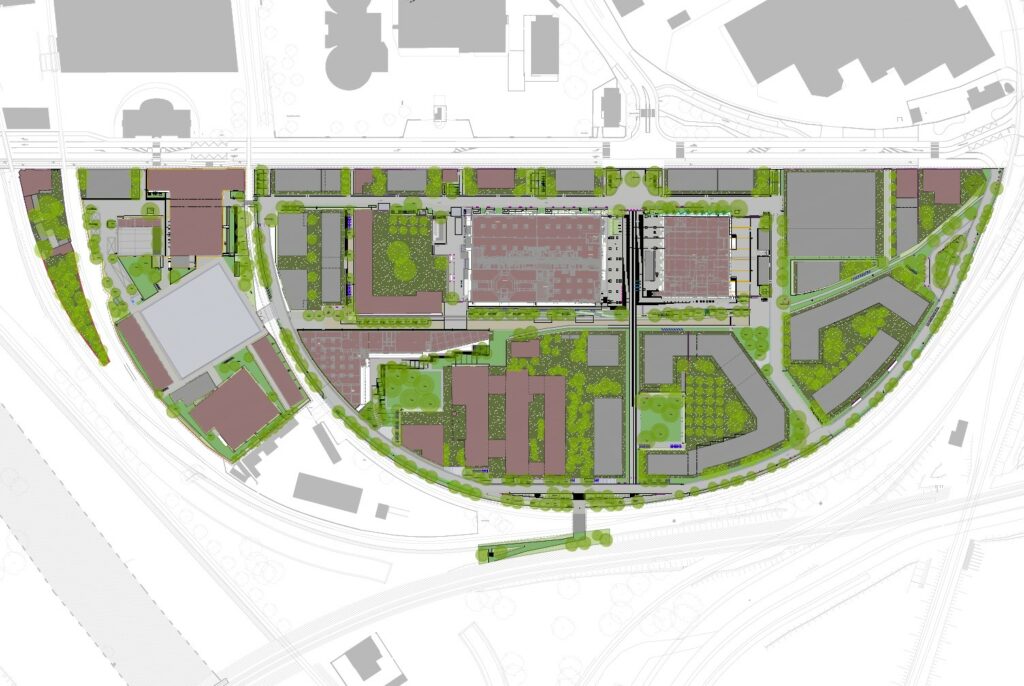
The Franco-German tramway, the real backbone of the region, opened the city of Strasbourg up to the banks of the Rhine and irrigated the planned spaces (Citadelle, Starlette, Coop, Rives & Port du Rhin). The new housing and public facilities of Citadelle, Starlette, Coop and Port du Rhin helped open up the historic district of Cité Loucheur and gave back urban life to the neglected industrial port. The buildings of the Coop, heavily damaged since the end of activity of the Coop Alsace, were gradually rehabilitated in line with the history of the place – including that of the artists, still installed around the “courtyard of miracles” – and the historical use of the buildings.
In 2021, following the change of team elected to the City and Eurométropole of Strasbourg, the Guide Plans had to adapt to better embody the ambitions and challenges raised by elected officials: a city of ecological transitions, resilient in the face of climate challenges; an inclusive, equitable city with a fine network of local services and facilities; democratic and participatory project governance.
Over the space of a year, SPL Deux Rives, Eurométropole and the City of Strasbourg, the teams of town planners, landscape architects from the TER-LIST-51N4E and A. Chemetoff agencies, the tribu environmental design office and technical design offices, worked on an evaluation and the project’s development paths.
This included strengthening its ecological ambition and adapting it to climate issues, both to minimise the carbon impact of projects and strengthen their resilience in the face of heat peaks. It was also a matter of compensating for the deficit of the first Guide Plans in social and affordable housing as well as in local public services and facilities.
At the time of the first Guide Plan, the public investment made was indeed too low to meet the needs for social housing at controlled prices, but also, to create the public facilities necessary for existing inhabitants, and the 8000 newcomers – (e.g. nursery, gym, etc.), or to avoid “overdensity” on certain sectors, a density that’s too high, to the detriment of the quality of housing and the fight against the “effects of urban heat”.
It was also a matter of rethinking the management of the project to strengthen its democratic, participatory dimension through information and the close association of inhabitants of the district and a new ambition given to implementing participatory projects, from housing to the co-design of public facilities and spaces. From the end of 2021, consultation actions and participatory projects were thus committed to concrete subjects (for more information, see the Participate page).
Better responding to the socio-economic, democratic and ecological challenges of today and tomorrow is thus the key objective of the developments carried out by SPL Deux Rives, its partners and elected officials.
For a detailed presentation of developments, see the article The urban project evolves. Deux-Rives, what’s the plan? (in French or German)
In a few figures
The great Deux-Rives / Zwei-Ufer project is:
- 250 ha under development, linking the district of Heyritz, on the banks of the Ill, to the city of Kehl, on the German bank of the Rhine.
- 1.5 million m² to be developed.
- 9000 new homes with nearly 1000 homes developed per year, or 20 000 new inhabitants in the long term.
The new stage of the great Deux-Rives / Zwei-Ufer project is:
- 74 hectares under transformation.
- 380 000 m² to be developed.
- 4 districts in progress: Citadel, Starlette, Coop and Rives & Port du Rhin.
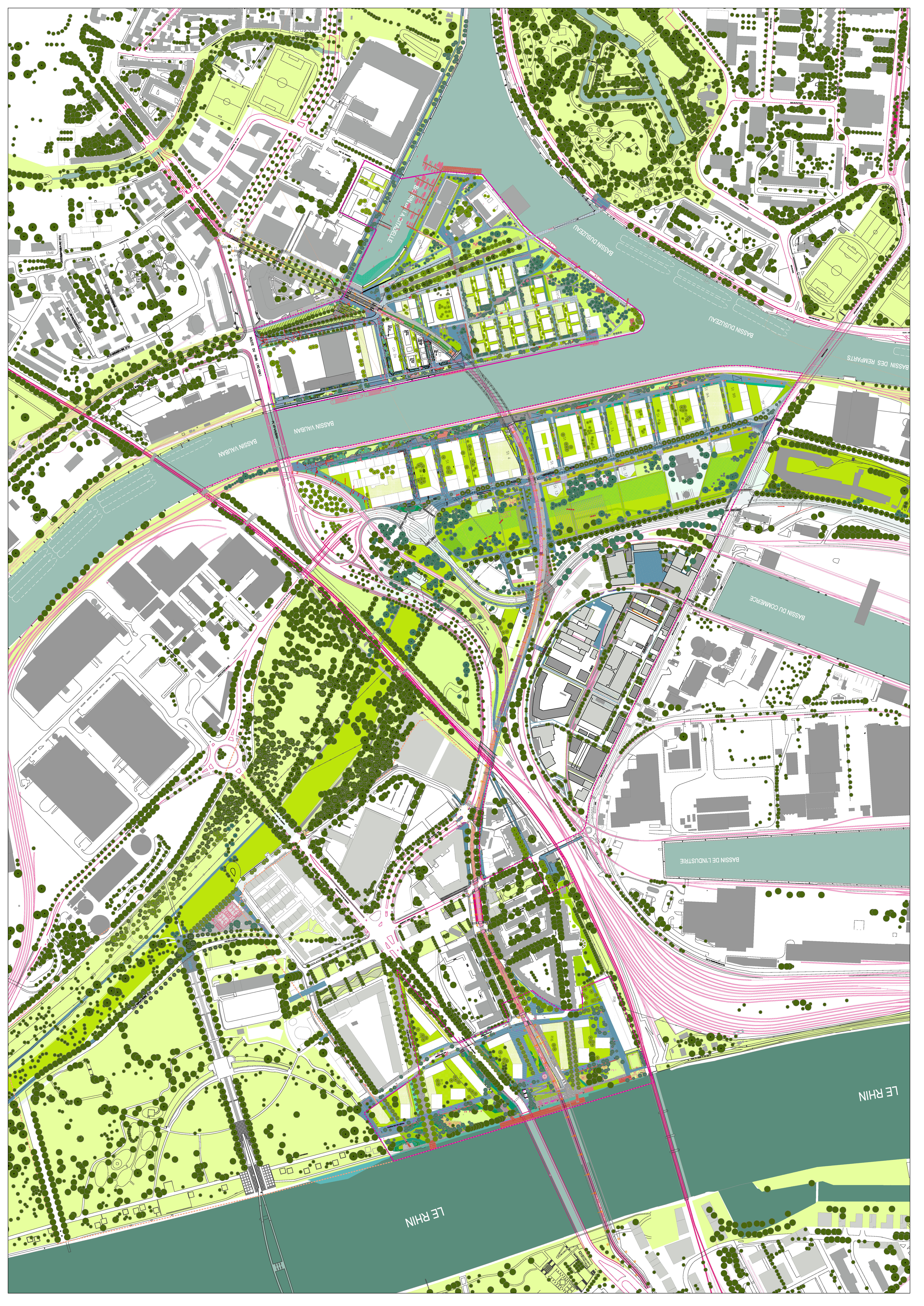
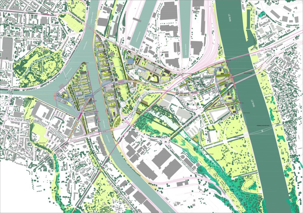
- More than 20 hectares of new green public spaces, structured by 2 new parks (Parc de la presqu’île Citadelle and Parc du petit Rhin), 3 large promenades (Promenade des quais Citadelle, Promenade des quais Starlette and Promenade du Rhin) as well as a network of local squares, paths and small squares in the heart of the 4 districts.
- More than 2000 trees planted.
- 3700 housing units, 40% of which are affordable housing (social and intermediate rental housing, social access, controlled prices) and 130 000 m² of socio-economic and cultural facilities and activities (public facilities, offices, leisure, workshops, training, shops, etc.).
- A transversal ecological approach (river logistics, ecological soil management, wooden construction, revegetation of public spaces and island cores, soft and sustainable mobility, “recycling” of COOP buildings, urban heating via a biomass boiler and recovery of end-energy of port companies, bioclimatic design, etc.).
Site of the project within Strasbourg
Urban strategies over the years
To understand the latest phase of the major Deux-Rives project we also need to discover the project background and geography, and how the project slots into the surrounding context and environment. It is important to understand the innovative method applied to the project, with its changing guide-strategies appealing to the collective intelligence and adapting themselves in light of subsequent proposals and feedback.
A pioneer right from the beginning, at the end of the 1990s, the Deux-Rives project is a reaction to urban sprawl where building development spreads beyond the city walls and gradually swallows up natural greenspaces and farmland. Prior to carrying out a study of its West-East axis, the City of Strasbourg had identified three main goals it wished to achieve, namely to:
– recycle urban spaces, by turning the abandoned port areas – former industrial sites – into new urban development plots, thereby preserving farmland and natural spaces,
– heal old wounds, by re-opening Strasbourg to the Rhine, previously a no man’s land, soon to be a linking feature and home port.
– speed up the ecological transition, thus consolidating the foundations for a resilient and united city, by carrying out a wide range of actions in different fields (energy, transport, housing, materials, public services and facilities, biodiversity, greening, etc.).
Contextual urban planning, situated architecture
The Deux-Rives project re-creates a continuous urban link with Germany, symbolising the vocation of the Eurometropolis. The 4 project districts also mean Strasbourg, as France’s 2nd largest inland port, is able to re-discover the Rhine and its impressive landscapes on a daily basis.
Architectural and urban grammar is contextual, historically and geographically rooted. It takes account of:
- the historical heritage, by engaging with the traditional Alsatian architecture and industrial port heritage for the choice of materials and size of new builds,
- the Rhine landscape, given that each district is a former island of the Rhine, before the river was tamed with its channels and basins,
- the intangible heritage of the site, and in particular the Coop, by re-interpreting the values of solidarity and sharing underpinning the former Coop Alsace, inspiring a genuine cooperative spirit in the City.
Revolution in the method
The 1st Master Plan was adopted back in 2012. The work of landscape artist Alfred Peter and urban developer Bernard Reichen, it proposed opening up the juxtaposed urban sites to re-create a continuous city centre extending all the way Germany. The initial plan included the route drawn for Line D of the tram network in anticipation of future urban development. This was already a mini-revolution in terms of the method and ambitions, insofar as new transport infrastructure is usually the last phase of such building projects. In the case of Strasbourg, however, the tram network performs a structuring role, easing pressure in the Port du Rhin area and ensuring that, as soon as they move in, the residents of the new districts have access to a good alternative to their cars in the form of a quick and reliable tram line. The ecological transition and an increase in transport by bike – complementing public transport – are key features of the entire project.
In 2016, two agencies extended the initial project with the SPL Deux-Rives, a publicly-owned local development corporation. Henri Bava (Agence TER with LIST and 51n4E), for the whole sector covered by the project, and Alexandre Chemetoff & Co, for the Coop district, delivered their “guide-plans”, setting out the framework for urban development and programming, but in a non-static way that allowed the project to evolve in response to the contributions and feedback received. Once again the method stands out for enabling adjustments to be made throughout the different project phases.
The principle is one of iteration: the project is constructed and enriched over time thanks to successive additions and achievements. It is a living project, one which can be adapted and improved thanks to a genuine co-constructionist approach. Project owner and manager, elected representatives, current and future inhabitants and workers, local residents, and associations are involved at every turn of the project process and on both sides of the border. Thus the latest phase in the Deux-Rives/Zwei-Ufer project is the fruit of an active, evolutive co-production – a real asset for a resilient city capable of adapting to not only present conditions and lifestyles but also those to come.
Presentday
The project factory
Why build, how, and with whom? How to reconcile city and nature? Why reduce the distance between where people live and where they work? How can citizens be involved in their future living environment? The new project is about re-thinking how to design the city so that traditional approaches can be left behind and plans adapted to suit the locality. Here we let you in on a few “manufacturing” secrets.
All articles by the factory
